Terrain Modeling Techniques in Architectural Scale Models
-

- by jhonesmichal,
- March 06, 2026
- in business,
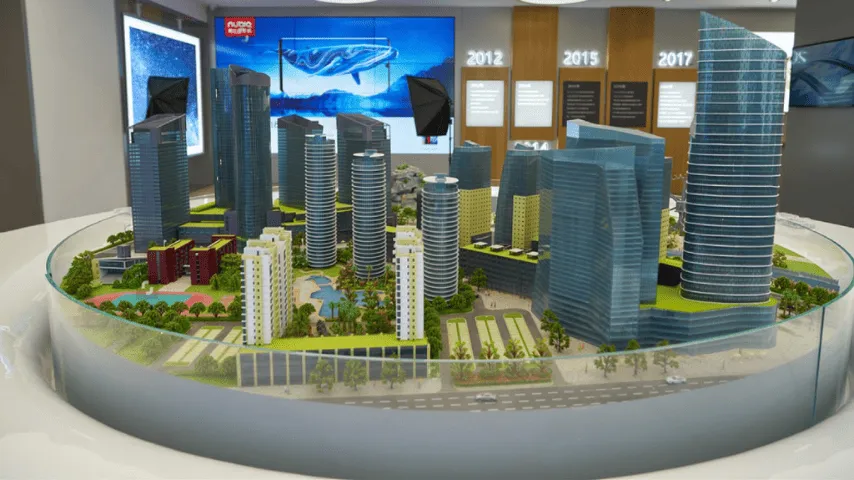
Terrain modeling plays an important role in representing the natural landscape surrounding a building project. It helps viewers understand how a structure interacts with slopes, elevations, roads, water bodies, and surrounding land features. Without accurate terrain representation, a scale model may fail to communicate the full context of a development.
Architects, developers, and planners rely on terrain models to evaluate how a project will sit within its environment. These models provide a physical interpretation of topography that cannot always be understood through flat drawings. Professional model makers apply several techniques to ensure the terrain looks realistic while maintaining the correct scale and proportions.
Using Contour Layering for Elevation Representation
One of the most common techniques for terrain modeling is contour layering. This method uses contour lines taken from topographic survey data. Each contour line represents a specific elevation level. Model makers convert these lines into stacked layers to replicate the rise and fall of the land.
Thin sheets of materials such as cardboard, foam board, or acrylic are cut according to the contour shapes. These layers are then stacked one above the other to create the landscape form. When viewed from the side, the layers resemble natural slopes and hills.
Once the contour layers are assembled, the model surface may be smoothed or refined to improve the appearance. This technique is especially useful for projects located in mountainous areas or sites with noticeable elevation differences. It allows viewers to easily understand how buildings are positioned across varying land levels.
CNC Milling for Accurate Landscape Shapes
CNC milling is another widely used method for creating terrain models. This technique uses computer-controlled machines to carve the landscape from solid blocks of material. Digital topographic data is first converted into a 3D model using specialized software.
The CNC machine then removes material layer by layer until the terrain shape is fully formed. Materials such as high-density foam, wood, or modeling boards are commonly used in this process. The result is a highly precise terrain surface that closely matches the original digital data.
Many studios offering architectural scale model making service rely on CNC milling for large or complex terrain models. The process allows model makers to reproduce smooth slopes, valleys, and elevation changes with a high level of accuracy. This precision is especially important for master planning models and large development projects.
3D Printing for Complex Topography
3D printing has become an increasingly valuable tool in terrain modeling. It allows model makers to create intricate landscape features that may be difficult to produce through traditional methods. Using digital terrain data, the model is printed layer by layer until the complete landform is produced.
This technique works well for representing irregular terrain such as cliffs, riverbanks, and detailed land contours. The printed model can also include subtle variations in elevation that enhance realism.
In an architectural scale model making service, 3D printing is often used for smaller terrain sections or detailed site models. The technology ensures that every elevation change is accurately reproduced. After printing, the terrain may be sanded, painted, or finished to match the surrounding environment of the model.
Hand Sculpting for Natural Finishing
Although digital techniques are widely used, hand sculpting still plays an important role in terrain modeling. Skilled model makers often refine the terrain manually after the base structure has been created. This step helps improve realism and smooth out any visible layering or machine marks.
Materials such as plaster, clay, or modeling compounds are applied to the terrain surface. These materials can be shaped to create gentle slopes, natural curves, and subtle land transitions. Hand sculpting allows model makers to add small details that may not be captured through automated processes.
This method is particularly useful when the terrain needs to blend naturally with landscaping elements like roads, pathways, and vegetation areas. By adjusting the surface manually, model makers can achieve a more organic appearance.
Texturing and Surface Detailing
Once the terrain shape is completed, the next step involves adding surface texture. This process enhances the visual realism of the model. Different materials are used to represent various landscape types.
For example, sand or fine gravel may be applied to represent rough ground or rocky surfaces. Static grass fibers can simulate grassy areas, while small stones can represent gravel paths or dry riverbeds. These textures help distinguish between different landscape zones within the project.
An architectural scale model making service carefully selects these materials to match the project’s environment. Whether the development is located in an urban area, desert landscape, or coastal setting, the terrain textures must accurately reflect the real site conditions.
Integrating Infrastructure with Terrain
Terrain models often include roads, pathways, bridges, and drainage systems. These elements must be integrated carefully into the landscape to maintain realistic proportions. Model makers design these features to follow the natural contours of the terrain.
Roads may be cut into the terrain surface or slightly raised depending on the site design. Bridges or retaining walls may also be added to demonstrate how infrastructure adapts to elevation changes. These details provide viewers with a clearer understanding of site accessibility and circulation.
Including infrastructure within the terrain model helps planners and clients visualize how the development connects with its surroundings. It also highlights how the landscape influences building placement and transportation routes.
Painting and Finishing Techniques
Color plays a key role in completing the terrain model. After the shape and textures are finished, the landscape is painted to represent natural ground conditions. Different shades of brown, green, and beige may be used to depict soil, vegetation, or sandy areas.
Airbrushing is often used to apply smooth color gradients across the terrain surface. This technique helps simulate natural variations in ground color. Additional painting may also be applied to highlight slopes, shadows, and elevation changes.
These finishing steps give the terrain model a polished appearance. They also help viewers easily distinguish between different landscape zones within the development.
Conclusion
Terrain modeling is a crucial element in architectural scale models because it provides important context for the building design. By accurately representing slopes, elevations, and land features, terrain models help architects and clients understand how a project interacts with its environment.
Various techniques such as contour layering, CNC milling, 3D printing, and hand sculpting are used to achieve this accuracy. Surface texturing, infrastructure integration, and careful painting further enhance the final result. Through these combined methods, terrain models become an effective tool for visualizing real-world landscapes.
A professional architectural scale model making service uses these techniques to ensure that terrain models are both precise and visually realistic. This attention to detail helps communicate site conditions clearly and supports better planning decisions throughout the design process.
0 Comments:
Leave a Reply